Miyako district in
east of Aizu-Bange town.
In the Aizu-Koruiki, Kawanuma county Murata-village-stockade, East-West
28-Ken(51m), North
-South 31-Ken(56m). In the Angen 2 year (1176 year), Kurosawajiri Uhyō-eno-jō
Masafusa, this
person is the second son of Kogorō Masakatsu, the fourth son Masatō of Abe-no-Yoritoki. Served
the Ōdera E-nichi-ji temple (Bandai-town, Yama county, Fukushima prefecture).
He lived here in
Murata on his territorial. It is said that the 28th generation Murata
Bunjiemon Fusanaga, he was
Rōnin (lost the samurai job) in Tenshō 17 year (1589 year). The location of the mansion is not
understood now. I guess that the area where Chōei-ji temple and National
route 49 pass is the
ruins of the mansion. It might have been destroyed by the construction
work of the three-way road
in the Meiji period.
(Welcome map, Aizu Bange
town East area map)
It is recorded that it was at the northern end of Tsukahara settlements
near the Ō-kawa river (Aga-
kawa river) to the east of Aizu-Bange town. In the Aizu-Kagami, Tsukahara-village-stockade, East-
West 36-Ken (66m), North-South 40-Ken (73m), Ninagawa Shōgen(*1) Toshikage was built and lived
in the Shōwa 2 year (1313 year), his grandson made Tsukahara his family
name. At the Tenbun
years (1532 year ~ 1554 year), Satō Yūma-no-suke Yoriharu lived there,
and it is said that his
descendants made Tsukahara the family name again. It is said in addition,
the mansion of Hirata
Hyōbu-Shōyū(*2), a vassal of the Ashina clan, is located in the north of the village,
and its scale is
East-West 2-Chyō 20-Ken (248m), North-South 2-Chyō 10-Ken (230m). There
seems to have been a
fairly large mansion, but it was damaged by repeated floods, and in later years it became a place of
the people's life, and it has now become a residential area. Inari shrine,
which is probably the god of
mansion in the north of the settlements, and the ruins of earthen walls
and waterways in the
surrounding area, only leave a slight trace of the ruins of the building.
(Welcome map, Aizu Bange town East area map)
Aizu-Bange town, a treasure trove of history and culture, has been home
to powerful clan and warlords since ancient times, and a
forward base of the rival countries is also built, and it is also a region where there have been various battles. I looked for the
remnant of the castle ruins and mansion etc. ruins, and took a walk around
the town. There are places that have been extinguished
and destroyed by residential land development, road maintenance, agricultural
farm land maintenance, etc., but there are places
where the place where the crisis was escaped are designated as historical sites with traces, and there are places where the people of
descendants still live. Let's visit the "remains of warriors’ dreams"
in Aizu-Bange, it was introduced in "Aizu-Bange town, Let's
walk! guide".The old castles and mansions are described according to the classification method of "Aizu-Koruiki". Aizu-Koruiki is
also called "Aizu-Kojyo-Rui-Saku" and does not know the time
of its establishment, but I guess it is the same time as "Aizu-Fudoki"
compiled during the Aizu rule period of Mr. Hoshina Masayuki. At that
time, it was the first time in Japan that local literature was
created together, such as the creation of books about Aizu and presenting them to the Shogunate. It is said that these documents of
Aizu came to be learned by other countries, and it was made and submitted, and it was said that it became a reference of the rule of
the countrys of the Shogunate. The domination system in the territory
of the Ashina period is the land stipend system, and it is the
one to divide the land to the vassal and to rule it. The vassals either
built a house in the territory given and lived in, or it was
governed by the local governor. This lord is called the Jitō (lord of the manor). The ruins of the mansion and the stockade in many
villages can be thought of as a Jitō residence. At the time of the invasion
of Aizu by Date Masamune in Tenshō17 year (1589 year),
the Kojyo-Rui-Kan in Aizu, which did not show his intention to swear allegiance,
it was been burned down, including shrines and
temples. From the rule of Mr. Gamoh, since the rule system in the territory became a Mura(village)-Kumi(group) system, it was not
reused except for some of the old castles and mansions. The Mura(village-Kumi
system was a management system by the Goh-
gashira (head of the village) that was introduced after the Taikoh’s (Toyotomi Hideyoshi) nationwide land survey. The Goh-gashira
was referred to as a Ō-na-nu-shi or a Ō-shō-ya, and the Ki-mo-iri was referred to as a Na-nu-shi or Shō-ya.
How to classify
the castle-mansion in Aizu-Ko-Rui-Ki is,
1.
the
Shiro (castle)
There is a moat inside and outside and full of water, the Ōte-mon gate
(the main gate), the Rear-gate (the back gate), the Do-rui
(large earthen wall), the Karamete-mon gate (four-sides castle gate),
the Yagura turret, and the Kaidate wall (the board wall).
This is called the six tools on the classification.
In the section of Kawanuma county, there are three castle places, Jin-ga-Mine-jyo castle, Kitada-jyo castle, and Sarumodoshi-jyo
castle, but Kitada-jyo castle is Shiokawa town in Kitakata city, and Sarumodoshi-jyo
castle is in Yanaizu town, Kawanuma county,
so it is not described.
2.
the Rui
(fortress)
It is similar to a castle, but it is a form
that does not have six tools.
There are nine
places in the section of Kawanuma county, but there are 6 places in the present
Kawanuma county Aizu-Bange town.
3.
the
Yakata or Date (Yakata) (mansion)
A form with a single moat, a Shiroto (castle-door,
main gate), a front and back-gate, and Do-tui (earthen wall).
There are 19
places in the section of Kawanuma county, but there are 13 places in the
present Kawanuma county, Aizu-Bange town.
4.
the
Saku (stockade)
It is a form with a single moat, an Do-rui (earthen wall), the guard fence,
the Karamete-mon gate (emergency exit), and the Shiro-to
(the castle-door, the main gate).
There are 29
places in the section of Kawanuma county, but there are 15 places in the
present Kawanuma county, Aizu-Bange town.
However, since there is a place where the administrative district has changed
at that time and now, it will be described only in Aizu-
bange town. Also, since I'm move by bicycle, it is not possible to cross
the Tohge pass (mountain pass) because of the fear of bear's
infestation, although it is limited, please refer to it when walking and picnic in the town. Please feel the small history of the neigh-
borhood of everyone in Aizu-Bange town.


Tōgen-ji temple,
located on the site of Hiwatasi-mansion
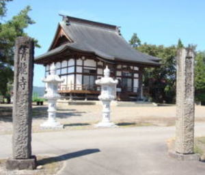
Seiryu-ji temple,
located on the site of Ōe-mansion
It is located in
the Wakamiya district, south of Aizu-Bange town.
In the Aizu-Koruiki, Ōe-village-rui (fortress), East-West 48-Ken (87m),
North-South 46-Ken (84m).
Around the time of the En-ryaku years (782 year ~ 806 year), Gūji (chief
priest of Shintō) Asuka
Shōyū Fujiuji Sanemoto lived here. It is called Ōe-no-shō (manor) from
this time. It is said that Mr.
Ōe was later there, and Ōe Hyōbu lived there by the time of Tenbun years (1532 year ~ 1555 year).
It is thought that Seiryū-ji temple was built on the site of Ōe-mansion.
There is no remnants of the
fortress and mansion in the temple area. The name of Ōe is, the "Wamyō
Ruijushō" of Kenkyū 5
year (937 year), there is a name of Ōe-gori(district) as Aizu-9-go(districts). Ōe-gori is assumed to be
the area of present-day Wakamiya, Bange, Kawanishi, and Yahata eastern.
The nationwide land
survey (survey of fields and harvest volume survey, current tax ledger
create) by Hashiba(later
Toyotomi) Hideyoshi that began in Tenshō 9 year (1581 year), the manor system was abolished
and Ōe-gori was abolished at the same time as the manor system was abolished,
but the name of
Ōe, which was the rule of Mr. Ōe, remained here.
(Welcome map, Aizu Bange
town South area map)
Ōe-village-rui(fortress)
ruins
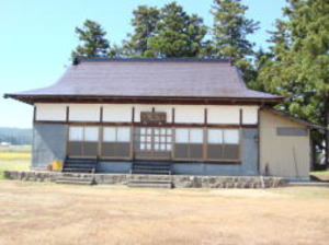
Choei-ji temple presumed to be
the site of the mansion
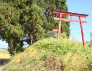
Inari Shrine enshrined in the ruins of
the earthen base, the residence god?
From Tsurunuma-bashi bridge on National route 49, take it to Aizu-Wakamatsu
city 0.7km,
and turn to left at the traffic light in front of JA-Yotsuba-Bange Kanagami-branch to about
0.5km in the Kanagami settlements. In the residential area surrounded
by trees in front of the
gate of the Shōjuzan Kinshō-ji temple, there are some remnants of the
moat and the earthen
wall, which reminds us of the past. According to the Aizu-Kagami, after Kitada Jirō (real name
Ashina Morihiro) was built a mansion with a range of East-West 75-Ken
(137m) and North-
South 80-Ken (146m), he returned to Kitada-jō castle (Shiokawa town, Kitakata city), and
Morihiro the child of Fujikura Moritsune moved to the mansion, and in
Kenkyū 4 year (1252
year) the Tsugawa-jō castle (Tsugawa district, Aga town, Higashi-Kanbara
county, Niigata
prefecture) was built and moved, and it is said the descendant Morihiro, called himself Mr.
Kanagami from the place name of the main territory. Even now, the descendants
of Mr.
Kanagami live there.
Mr. Kanagami was a brave family of successive fighting factions, served
as the regent of the Ashina family, served as the Jitō (lord of the manor)
of the Kanagami for
15 generations until Morihiro and Moriharu, and also served as the lord of Tsugawa-jō castle,
and served as an important post as a Shikken (regent) of the Ashina family
for 330 years from
the Kenchō 4 year (1252 Year) to Tenshō 17 year (1589 year).
(Welcome map, Aizu Bange town East area map)
Kanagami-mansion
ruins
Not yet investigated, the remains of the government district office in
the Manor-period and the ruins of the mansion destroyed in the Middle period.
Mandokoro-mansion ruins
It is located in the northeast of Aizu-Bange town, in the east side of
the "Soba-dokoro(shop) Kuruma-
ya" in Numakoshi settlements. It is on the fluvial terrace about 5m
high. There is record in the Aizu
-Koruiki, Magarinuma-stockade, East-West 21-Ken (38m), North-South 24-Ken (44m), and Ōnuma
Danjō Hidemasa lived there. At the mansion of the vassal of Ashina family,
Tnshō 17 year (1589 year) it was the castle fell by the attack of the Date army at the time of the Aizu
invasion of Date Masamune. The domination system was changed by the Aizu
rule of Mr. Gamō, so
the mansion was not rebuilt and became a farmland.
(Welcome map, Aizu Bange town North-West area
map)
Jingamine-jyo castle ruins
The southern end of Aizu-Bange town, near the Ban-Etsu (Iwaki city, Fukushima
prefecture and
Niigata city, Niigata prefecture) Highway Niitsuru IC (ETC only). And
west of the Takada-Kaidō
road in Kami-Kanazawa settlements in the Gonohei district. It is located at the alluvial fan end
of the ancient Sakase-gawa river, and is located on a tongue-shaped plateau
that protrudes to
the north. In the Aizu-Koruiki says, "Kanazawa-village-stockade,
East-West 60-Ken (109m),
North-South 41-Ken (75m), it was built and lived in Fujiwara-no-Ōkura Shōyū Masanori, a
surrogate of the old time Gūji (chief priest of Shintō). It is said that
it was around the Kan-nin 3
year (1019 year). In this year, the Ryūdenzan Hōzō-ji temple was built
in the Shimo-Kanazawa
settlements by Fujiwara-no-Masanori. It is said that the son of Ninagawa Jirō Kagetsura,
Minbu Ooi Kageyoshi, lived there in Kenkyū years (1190 year ~ 1198 year).
The Ninagawa
Kagetsura is, a family of the Sawara clan that begins with the ancestor
of the Ashina family,
Sawara Jūrō Yoshitsura. In the days of Ōei years (1394 year ~ 1427 year), Ishida Masaoki lived.
After that, Doi Zaemon-no-jō Katsutō lived. It called this person Kanazawa
Zaemon. It said, he
was lived in Tenshō years (1573 year ~ 1593 year). Kanazawa village is the current Shimo-
Kanazawa settlements. "Kanazawa-village-stockade" is also called
"Ippai (one cup)-mansion",
and it is described in the Aizu-Kagami that the details of why it is called
Ippai-mansion are not
transmitted. It is Ippai-mansion…, the lord liked to drink Sake…? The entire ruins are privately
owned and farmland.Although the earthen wall and the moat etc. do not hold the original shape
in the field maintenance etc., the excavation by the town before the construction
of Ban-Etsu
Highway road and field maintenance in the vicinity proved to be a composite
ruins from late
Jōmon period and Yayoi period to Medieval.In Tenshō 17 year (1589 year), during the invasion
of Aizu by Date Masamune, the Hōzō-ji temple in Shimo-Kanazawa was caught
in war fire and
burned down. At the same time, it think that Kanazawa-mansion was too also burned down by
the war fire.The original Kami-Kanazawa settlements was just south of Shimo-Kanazawa
settlements. It is said that it moved to its present location after a
Shiro-Hige-no-Ōmizu(large
flood of white beard) in Tenbun 5 year (1536 year).
(Welcome map, Aizu Bange town South area map)
West of Aizu-Bange town. It is said that the area of the hot-water-reservoir south along the old prefectural road Tōdera-Akaru line about 250m south, from the railroad crossing of JR Tadami
line, in front of Sugi Yakushi in Sugi settlements is the ruins of the
mansion. This road was an
ancient Echigo-Kaidō road (road on the side of mountain), and it was also
the getaway route to
Kanuma (Kanuma city, Tochigi prefecture) of the legendary thief "Tōdera Hattan". The current
situation is cultivated land, and it is to see the estimated traces of
the earthen wall in part.
In the immediate vicinity, there is a stone-shrine of "Susano-o shrine" which enshrines "Susano
-o-no-Mikoto" whether it was a mansion-god. If you stand here, you can see the whole area of
Aizu-Bange town, and it is easy to judge that it is a great place to set up a castle-mansion.
In the Aizu-Koruiki, Sugi-village-mansion, Eas-West 32-Ken(58m), North-South 20-Ken(36m),
Tajiri Yamato build and lived. His descendants, Tajiri Izumi, Hasegawa
Magozaemon, and
Kurosawa Gyōbuzaemon, three brothers were lived there. The ancestor is, descendants of Abe
-no-Sadatō’s younger brother Masatō. It is said that it became East-West
50-Ken (91m), North-
South 30-Ken (55m) when it was the Tenshō period (1573 year ~ 1591 year).
Abe-no-Sadatō is the leader of the Ōshū side at the time in Former-9-years-war
(1051 year ~
1062 year), and a person who fought with the Imperial court’s Minamoto-no-Yoriyoshi and
Yoshiie parent-child. Please refer to the page of "Welcome Material"
for details of the Former-9-
years-war. The person related to Abe-no-Sadatō in the Former-9-years-war lived in Aizu-Bange
in the Mr. Ashina period isn’t it?
The descendants
still lives in this settlements in now.
(Welcome map, Aizu Bange
town Sugi area map)
According to the Shinpen-Aizu-Fudoki, at that time Aozu was a castle area 78 houses, the scale
East-West 2-CHyō 50-Ken(310m), North-South 3-Chyō 18-Ken(360m), surrounded
the entire
village with moats and earthen walls. It was same the Sōgamae (outer citadel)
structure of the
so-called Ōsaka-jō castle(Ōsaka city, Ōsaka prefecture) and Odawara-jō castle(Odawara city,
Kanagawa prefecture). Tenshō 17 year (1589 year) in June, when Date Masamune
invaded
Aizu, Date-army also attacked Aozu. But at that time, drew water into the
moat from the
Nippashi-gawa river, which was flowing close to the village, and took the attack of Date-army for
a week but endure and Date-army were gave up the capture and withdrew.
Nippashi-gawa river
flows the north of this settlements at that time, and it is a citadel
of the iron wall which is a
natural moat, and the moat seems to have been dry moat in peacetime. The moat was dug
around the entire Aozu settlements and was called "Namae-Sotobori
(outer moat)". Most of them
have been destroyed by Farm field maintenance and agricultural road maintenance,
and one of
them maximum width 30m, 10 meters height, and 200 meters length, keeping a vestige at the
east end of the settlements. It reminds you of a medieval fortress. You
can also see the structural
remains that are presumed to be the Koguchi (tiger mouth, medieval castle
entrance) of that
time. The part that is the farm road between Aoki settlements and Aozu settlements is the site
of the outer moat. It is said the Namae-mansion is the house of Mr. Namae
the lord of Aozu,
when Mr. Ashina in the medieval was the lord of Aizu, and is built by
Namae Taizen Motouji
the scale East-West 102-Ken(186m), North-South 38-Ken(38m). Even now, the descendants live
there. The mansion was originally built in the back-circular-part of Kamegamori-Kofun,
but for
defense reasons, the building was set up at its current location, and
it has reached the present
day. This is a reason why the hill in the back-circular-part of Kamegamori-Kofun is being to
scrape off. The lord of Aozu in medieval period the Namae family is, ancestors
are descendants
of Yūki Shichirō Tomomitsu of the Yūki clan based in Yashū Yūki (Yūki city,
Tochigi prefecture),
which produced Minamoto-no-Yoritomo’s nanny, and Namae Taizen is the grandson of the third
generation of Yūki-Kōzuke-Nyūdō-Tadamichi. Around Kōryaku 2 year(1380
year), Namae Taizen
worshiped Aozu 1200-Koku(equivarent to 40 million yen in terms of current
rice price) from Mr.
Ashina, and the governing this area until the beginning of Meiji period continued, and the family
still lives here. When the Aizu rule of Mr. Ashina entered a stable period,
the warlords of Mr.
Ashina moved to Aozu one after another, and the one large castle-mansion
was formed to such
a way as to protect and solidify the Namae-mansion. The warlords are called
"Aozu eight people
(Akutagawa, Unai, Ebana, Katō, Koike, Sanuki, Shirai, Matsumoto)",
and there is also a family
name that has been moved out, but the people of the descendants still
live in Aozu or in Aizu-
Bange town.
(Welcome map, Aizu Bange town North-West area
map)
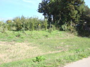
In the Aizu-Kagami, stockade, East-West 48-Ken(87m), North-South 30-Ken(55m), it is called
Kobori-mansion. It is said that Itō Taizen built it, and later Watanabe
Kenmotsu lived there.
Details of the year of mansion construction are not record. In general,
it is called Itō-mansion.
It is around the Takasago-ya brewery factory behind the Takasago-ya shop
in the Hashimoto
district. It is said that the shrine in the shadow of a private house
next to the west of the factory,
and which is in the place where it is hard to find, was Hachiman shrine,
and it was the residence
-god of Kobori-mansion. The name of the old town around here was called
Futaba-chyō. As a
remnant of the mansion ruins, there are still Aza place names such as Higashi-yashiki-zoe and
Ie-no-mae. Mr. Ito and Mr. Watanabe the owner of the mansion, are well
not sure what’s went on
after that. I think that it is related to the battle of Suriage-hara at
the time of the invasion of Aizu
of Date Masamune, or the related to Mr. Kurimura's appointment as the Jitō (lord of the manor)
of Bange. However, many people who are derived from both family and are
considered to be
genealogy and descendants live in the Hashimoto districts. From the Dainomiya-park
of the
shrine in the precincts of the Goshoku shrine to this area, it is the oldest area in Aizu-Bange town,
and it is the area where people began to live around from the Jōmon period.
The battle of Suriage-hara is that in Tenshyō 17 year(1589 year), Date Masamune invaded Aizu,
and Mr. Ashina marched to avenge in the Suriage-hara area between the
southern foot of Mt. Bandai and the north shore of Lake Inawashiro, and
it was a fierce battle with Date’s army.
In this battle, Mr. Inawashiro, who is also the Mr. Ashina clan, go together
to the Date army, so
the form of the Ashina army becomes disadvantageous, and the main heavy vassals are defeated
by the war death. The owner, Mr. Yoshihiro, flee to his parents, Hitachi
(Ibaraki prefecture) Mr.
Satake, and reached the end of Mr. Ashina's rule in Aizu.
(Welcome map, Aizu Bange
town Center area map)
In the Aizu-Koruiki, it is called Kasamamatsu-mansion in the Ei-nin 4 year
(1296 year, end of
Kamakura period), East-West 73-Ken (133m), North-South 59-Ken (107m).
It is called
Kurimura-mansion in old times. In the Ei-nin 4 year, Miura Iwami-no-kami
Moritsune (in later
years, changed to Fujikura Tokimori his name) built and lived here. When the Genki years (1570
year ~ 1573 year), Kurimura Danjō Moriharu was lived in. It is said, moved
Jōrin-ji temple in
here now. During the Genki and Tensho years (1570 year ~ 1593 year), it
was recorded that there
was a mansion (around the cemetery on the west side of the Jōrin-ji temple precincts) of Jitō (lord
of the manor) Mr. Kurimura of Kurimura-village. There is no trace of it
now. In addition, the
Echigo-Kaidō road was sometimes passed on the north side of the precincts of Jōrin-ji temple in
the old old days. The name of the Aza-place of this place is called "Tate-no-uchi
(in mansion)" and
the surrounding area is called "Tate-no-shita (under mansion)".
In the precincts, there is a grave
of the benefactor Kurimura Danjō of Aizu-Bange town.
In the grave area behind the Hiyoke Jizō-
dō hall in the precincts, a small stone Kurimura Inari shrine is enshrined.
This is the residence
god of Kurimura-mansion, and it is the former god of the present Kurimura-shrine. It is said that
the 24th chief priest of this temple discovered it from in the grass by
chance. And, the rear area is
the place where it is presumed that there was Kurimura-mansion in the
Middle period of the
Aizu rule of Mr. Ashiruna. The right of the picture is Kurimura Inari-shrine, the residence god of
Kurimura-mansion, and Kumano-s Shrine on the left. During the Boshin-war
of Meiji Restorat
ion, the Echigo Nagaoka Domain (Nagaoka city, Niigata prefecture) sent
reinforcements to Aizu,
put it’s the headquarters at Jōrin-ji temple, and it’s said the fought
against the Western-army
in various parts of Aizu.Mr. Kurimura is a powerful vassal member of the Kamakura Shogunate,
based in Miura-county, Sagami country (Yokosuka city, Kanagawa prefecture),
and Sawara Jūrō
Yoshitsura of the Miuraclan in Bando (Kantō) 8 Heishi, after worshiping
Aizu from Minamoto-no-
Yoritomo after the ŌshūFujiwaraclan subjugation, the third son Moriyoshi of the child Moritsura
The ruins of castle mansion in Aizu-Bange town
About 1km to the south of the
T-shaped road in front of Ōe settlements in Wakamiya district.
It is located at the southern end of the Hiwatashi settlements of the place
which passed through
the tunnel of the Ban-Etsu highway. In the Aizu-Koruiki, East-West 38-Ken (69m), North-South
31-Ken (56m), Yama-no-uchi Matashichi lived in Bunmei years (1469 year
~ 1486 year). At the
time of Tenshō years (1573 year ~1591 year), it is the place where the
Hiwatashi-mansion,
which was written as the
residence of Hiwatashi Yajirō lived. At first, Mr. Yama-no-uchi lived
there, and after that, it became the rule of Mr. Hiwatashi, and it is
thought that Tōgen-ji temple
was built on the site of the Hiwatashi-mansion in later years. Mr. Yama-no-uchi and Mr. Hiwa
tashi are both warlords of the vassals of the Mr. Ashina’s genealogy. It is said that at the time
of the invasion of Aizu by Date Masamune in Tenshō 17 year (1589 year),
the whole village was
burned down because all the villagers of Hiwatashi did not obey the order of Masamune.
Looking out the direction of Mt. Bandai from the temple area, the view of the Aizu plain spreads,
in a perfect location as a military base, the entire topography is reminiscent
of the ruins of the
mansion.
(Welcome map, Aizu Bange town South area map)
Hiwatashi-mansion
ruins
Murata-village-stockade
ruins
Tsukahara-mansion ruins
Sugi-mansion ruins
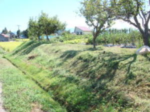
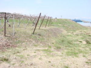
View of the ruins of mansion and
earthen wall.
Magarinuma-mansion
ruins
Sotobori (outer moat)-bashi bridge ruins
(Grating)
The road on the left and right is the ruin
of the outer moat.
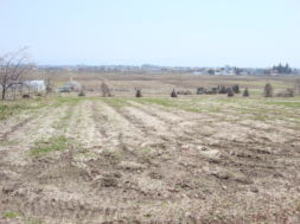
The honmaru site is a arable land.
Earthen wall ruins on the north side.
The waterway is
the trace of the moat.
View of the ruins of mansion and
earthen wall.
This lord liked to
drink Sake?
Kanazawa-village-stockade
(Ippai-mansion) ruins
Kurimura-mansion ruins
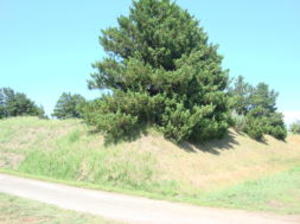
Earthen wall
ruins on the north side.
Earthen wall
ruins on the west side.
The waterway is
the trace of the moat.
Traces of earthen
walls?
Full view of the
ruins of the mansion
Can see the town in the distance.
The ruins of
mansion of descendant of Mr. Abe of the Former-9-years-war
The remains that seem to be Aozu-village-stockade Koguchi (tiger mouth)
The height difference between the village
and the rice fields below is about 20m.
Namae-mansion Nagaya-mon gate
Namae outer moat ruins
The fort of the
iron wall which failed to capture even Date Masamune
Aozu-village-stockade
ruin
Distant view of Mandokoro-mansion
Earthen wall ruins in the precincts
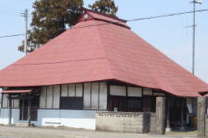
Jūfuku-ji temple at the site of
the Mandokoro-mansion
Distant view of Ninagawa-shō
government office ruins
About 2.2km north of town, it is said that the area of Chōfuku-ji temple,
located at the western
end of Shimo-Mandokoro settlements, is the site of the mansion. The Nara
and Heian period the
Shimo-Mandokoro is a "Ko-no-e-family's territory inventory" of the Kyoto Yōmei-Bunko, and it
was a Reizei-family’ territory. It is said the ruins of the government
office of Ninagawa-shō in
the manor of the Sekkan-family’s territory in the territory of Reizei-no-miya
Princess Kenshi (the name of the modern style is Tamako). Since not excavations
have been made, details are
not known. Around the precincts of Chōfuku-ji temple, can see the traces that seem to be the
remains of the earthen walls.
Until Shōwa 35s (1960s), from the fields of this area, celadon jar and dish debris from the
continent, which seems to be in Nara and Heian periods, were excavated.
(Welcome map, Aizu Bange town North-West area
map)

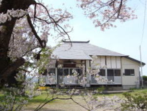
Near Takasago-ya Shoten's factory,
the estimated area of Kobori-mansion
There is Hachiman shrine in the back
of the building on the right.
Hachiman shrine
Inari shrine
The remains of the mansion of the benefactor of this
town development
3km north of the Kawanishi-Kaidō road intersection on Route 49, and further 0.7 km north of
"Kami-Unai Yakushi". It is located on a cliff raised by the
activity of the "Aizu basin western
edge fault zone" and is built on a site of important area that can overlook the area near
the
western end of the Aizu basin. It is a medieval castle ruins that have been designated as a
national historic site. It is a 12th-century castle ruins, which are very
few in Japan, with double
dry moats in the south, west and north, and the castle area is 50,000
m². In the Aizu-Ko-Rui-Ki,
Eien 2 year (988 year, the Heian period), Echigo-no-kami Jyō Shirō Shigenori builds 8 mansions
in Kawanuma county, (middle part omission) it is said that Minami (south)-U-nai-Rui
(fortress)
and it called "Jingamine-jō castle". This castle built by Mr. Jō was, it can be said the first full-
fledged castle-mansion building in Aizu. In the Sinpen-Aizu-Fudoki, it is said that it is one of
28-mansions built by Jō Shirō Nagamochi, the scale is East-West 1-Chō 30-Ken(164m), South-
North 1-Chō 40-Ken(182m), it is described as. This was around the time
of Hoan 1 year (1120
year, end of Heian period), and it was around the peak of his heyday as Mr. Jō. There is also the
possibility of "Aizu-no-Shiro (castle)" that appears in Kujō
Kanezane's diary Gyokuyō and
"Heike-Mono-gatari (the tale of the Heike)", and it is the castle ruins that are attracting the
most attention in Fukushima prefecture. The remains are well preserved,
and it is a first-class
historic site as a castle ruins in the Medieval. Because it is a part
of Japanese history, I want to
convey it carefully to future generations.
Double dry moats in the south, west and north are 15 meters depth and some
places span 60
meters width. The east, it is an erosion cliff of the Tsurunuma-gawa river
with a height of 20
meters, and at that time, the tributary of the Tsurunuma-gawa river was
flowing under it.
Part of the double dry moat is thought seems to be a moat before Mr. Jō, and it is thought that
Mr. Jō renovated the residence of one of the power persons of U-nai and
Aozu. Koguchi (tiger
mouth, medieval castle entrance) and the earthen walls also retain the
prototype of the time,
and on the north side of the castle area, you can also see traces of whether
the Ninomaru (outer
citadel) was placed. In the battle at the Heian period, mainly with bows
and arrows, such a huge
moat
is not necessary, but it is presumed that it is intended to represent the power
and
authority of the castle lord. Now this area is private land and caltivated
and. The Aizu-Bange town board of education has conducted three excavations since Heisei 14 year (2002 year).
inherited the land of Fujikura (Fujikura, Kawahigashitown, Aizu-Wakamatsu
city) and took the Fujikura family name. At the time
of the child's Moritsune, he worships Shichi-no-miya (Shiokawa town, Kitakata
city) and takes his family name as the Shichi-no-
miya family name, and Kurimura (Aizu-Bange town, Jōrin-ji temple area)
is also owned. The residence at this time is Kitada-jō
castle (Shiokawa town, Kitakata city). He moved to Kurimura at Moritoshi and became The Jitō (estate steward) of the land, built
the Kurimura-mansion and took his last name in Kurimura, serving as the Jitō of the area for 293 years from Ei-nin 4 year (1296
year, the end of the Kamakura Shogunate) to Tenshō 17 year (1587 year,
the year of Toyotomi Hideyoshi Kyūshū suppression).
For the genealogy of Mr. Kurimura, please refer to "Koransho materials". The Jitō is a position that manages land and farmers
directly by looking at the military, police, tax collection, and administration
of manors and public territories instead of the lord.
To put it simply, it would be called a tax collector with military and
police force. From the Ritsuryō of the Nara period to the Middle
period, the official name of the Jitō is Danjō.
(Welcome map, Aizu Bange town Center area map)
Kumano shrine Kurimura shrine
Kurimura Danjō's Grave
As a result, from the ruins of the castle, Songperiod (around the 12th century) Chinese white porcelain jar and Korean Goryeo(Korai,
Kokuri) celadon bowl were excavated, and in addition, for the first time
in Eastern- Japan, copper weight(weight of weighing) had
been excavated.
(Welcome map, Aizu Bange town North-West area
map)
Nationally Designated Historic Site..
The ruins of one
of the best in Japan’s medieval castle.
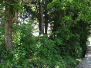
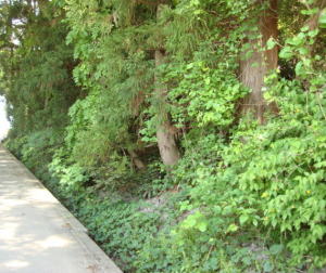
Iinner moat of double dry moat on west side.
Mounds of left and right is the earthen wall.
The ruins of the dry moat on south side
The castle area is under the arrow.
Distant view of the ruins of Jingamine-jō.
Push the bottan

